
'%3E%3Cg transform='matrix(16 0 0 16 -1647.5 -1531.2)' fill='none' stroke='%231d294f' stroke-linecap='round' stroke-linejoin='round' stroke-width='.5'%3E%3Cpath d='m121.98 127.76c-0.17689-0.25929-0.43221-0.47949-0.52086-0.82074-0.0804-0.3665-0.21074-0.59019-0.42616-0.72606l-8.3969-6.566c-0.80889-1.592-0.36001-1.8363-0.0316-2.2097l10.67 9.5964-9.5333-12.564c-1.143 0.67661-1.1798 1.8274-1.168 2.9989'/%3E%3Cpath d='m113.8 114.53c-0.24523-1.7095 0.43356-2.0329 1.3574-1.9887l8.2391 14.679'/%3E%3Cpath d='m115.13 112.45c0.29977-1.4292 1.091-2.1507 2.0519-1.9256 0.55822-0.76427 0.91952-1.7369 2.5885-1.3258 0.85906-0.79567 1.7166-1.5981 2.9042-0.91545'/%3E%3Cpath d='m122.54 108.28c1.1781-0.59147 2.1673-0.64808 2.8411 0.1894 1.2493-0.0237 2.6335-0.13253 2.336 0.82075 1.0406 0.20401 2.4264-0.0236 2.5254 1.3574 1.6748 0.51499 1.8097 1.107 1.8309 1.7046 1.5457 1.2255 1.8151 2.0449 1.5152 2.6832 1.479 1.198 0.62595 1.6187 0.75762 2.3676 0.11915 0.9679 0.21187 1.8962 0 2.3675-0.81373 1.3061-3.4159 2.4942-4.8929 3.5355l-3.7249 2.8726c-0.244 0.2787-0.22631 0.59711-0.31569 0.91551 0 0.0105 0.0149 0.71068 8e-3 0.30781'/%3E%3Cpath d='m117.15 110.62 6.345 16.557-3.6934-17.946'/%3E%3Cpath d='m122.51 108.31 0.91545 18.735 1.7678-18.735'/%3E%3Cpath d='m127.78 109.16-4.4194 17.962 6.8817-16.462'/%3E%3Cpath d='m132.05 112.16-8.6021 14.994 10.18-12.217'/%3E%3Cpath d='m134.22 117.5-10.875 9.5807'/%3E%3Cpath d='m119.94 125.37c-0.0426 1.3351 0.83865 2.0798 1.7836 2.5096 1.3187 0.15538 2.4687 0.0857 3.5355-0.0947 2.0017-0.44463 2.1106-1.7517 2.1308-2.8568'/%3E%3C/g%3E%3C/g%3E%3C/svg%3E%0A) Seafood Safety
Seafood SafetyVibrio Online Tools
In partnership with the FAO the Reference Centre is aiming to develop a number of online tools which will help the international community monitor the risk of contamination of bivalve molluscs with Vibrio spp..
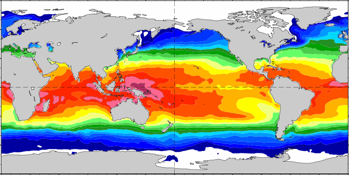
The Vibrio Map Viewer, developed in collaboration with the European Centre for Disease Prevention and Control (ECDC) and others, is a near real-time model that uses daily updated remote sensing data to examine worldwide environmental conditions, such as sea surface temperature and salinity for Vibrio spp.. The model used for the Vibrio Map Viewer has been calibrated to the Baltic Region in Northern Europe and might not apply to other worldwide settings prior to validation. The Vibrio Map Viewer is also one of a range of oceanographic data visualisation tools available from the US National Oceanic and Atmospheric Administration (NOAA) as part of its Ocean Viewer platform (select Vibrio Risk from the menu then choose either Daily, Cumulative or Forecast Vibrio Risk).
The Vibrio parahaemolyticus global phylogeny tool, using the Microreact application, shows the phylogenetic relationships, geographic distribution and timeline of a collection of more than 1300 V. parahaemolyticus genomes. The collection comprises genomes available from public databases (NCBI) along with genomes from strains deposited in the Reference Centre's V. parahaemolyticus global culture collection, covering particularly areas of the world underrepresented in the public databases. NOTE: this tool may not work with Microsoft web browsers and is best viewed using Chrome, Firefox or Safari.