Data Sets
Coastal Temperature Network
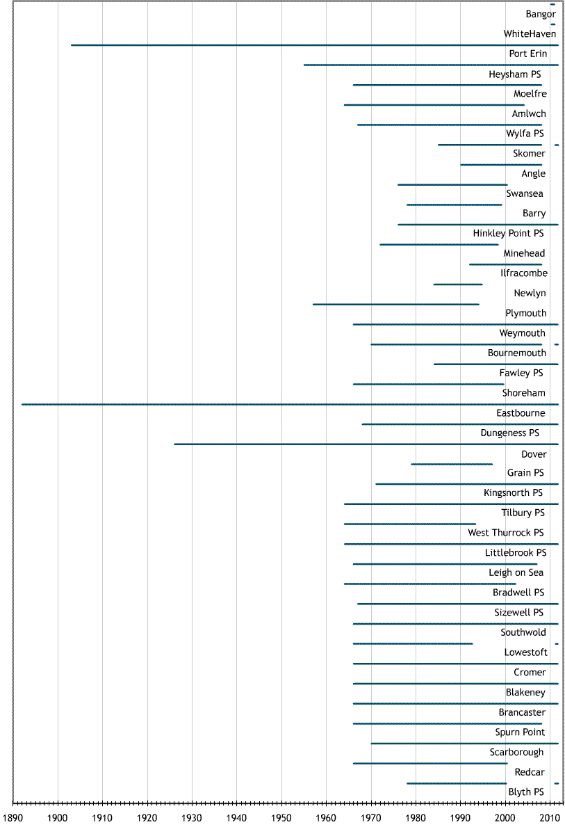
Individuals on behalf of Cefas, councils, companies and other organisations have obtained records of coastal sea surface temperatures, for some stations, of more than 100 years duration. Approximately half of the stations started recording coastal temperatures in the mid 1960s. There are 30 stations in England and 8 stations in Wales and the Isle of Man where 25 out of 38 are still in operation (2004).
Ferry Route 52°N: Salinity and Temperature
Near surface temperature and salinity samples has been collected by ferries, the most recent, the Stena Partner, along 52°N between Harwich (formerly Felixstowe) and Rotterdam, from August 1970 onwards. Throughout the year, at weekly intervals, temperature data is recorded and water samples are taken at 9 standard station positions across the Southern Bight of the North Sea. These are sent back to Cefas to be analysed for salinity and nutrients (from 6/2006). This provides an insight to the seasonal, inter-annual and decadal variability of surface water in this area.
Time span of the coastal temperature network and Ferry route datasets