Citizen scientists in remote UK territory reveal it as biodiversity superpower
16 December 2022
- Incredible video footage and photos reveal hidden underwater world of the Pitcairn Islands. [WeTransfer file] https://we.tl/t-JvHN3VWx8m
- Expedition carried out by 12 members of local Pitcairn community who were trained by video link during the CV19 pandemic.
- Results show how one of the world’s largest Marine Protected Area is supporting high levels of biodiversity.
- New evidence suggests Pitcairn’s coral reefs also showing resilience to climate change.
Volunteers from the Pitcairn Islands have showcased the incredible biodiversity thriving in their vast and remote waters thanks to a UK marine protection scheme.
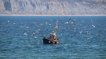
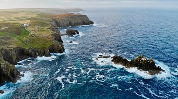
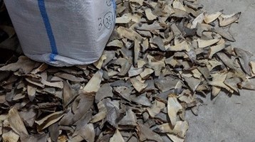
Commercial fishing, drilling and other extractive activities have been banned in the UK Overseas Territory’s 842,000-km2 marine protected area (MPA) since 2019. Shark fishing was prohibited in 2018.
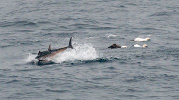
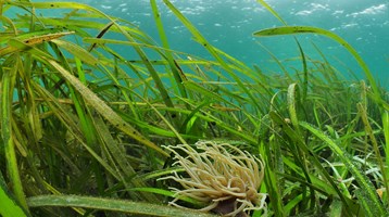
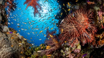
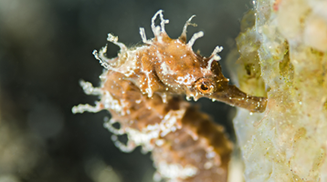
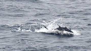
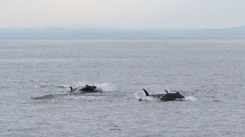
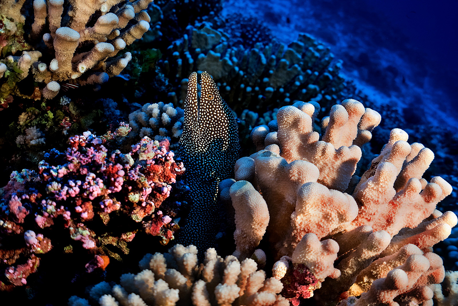
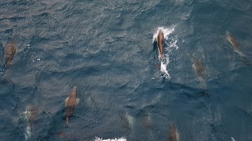
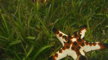
Now a report has revealed the islands’ Pacific Ocean waters are home to an abundance of rare marine life, including endangered humpback whales, sharks and more than 200 species of fish.
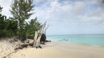
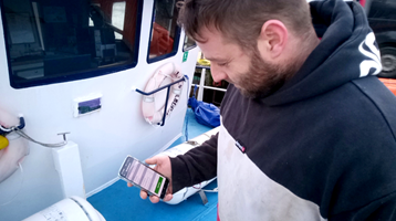
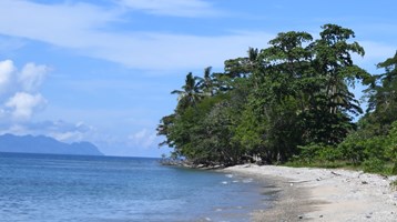
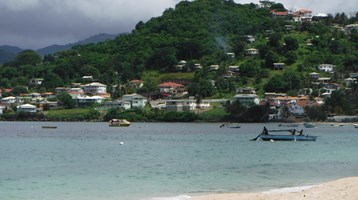
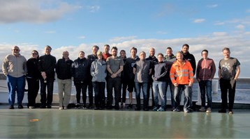
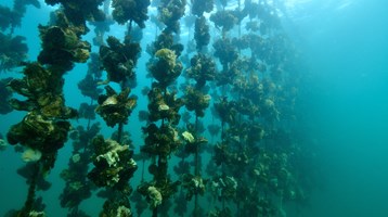
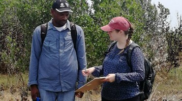
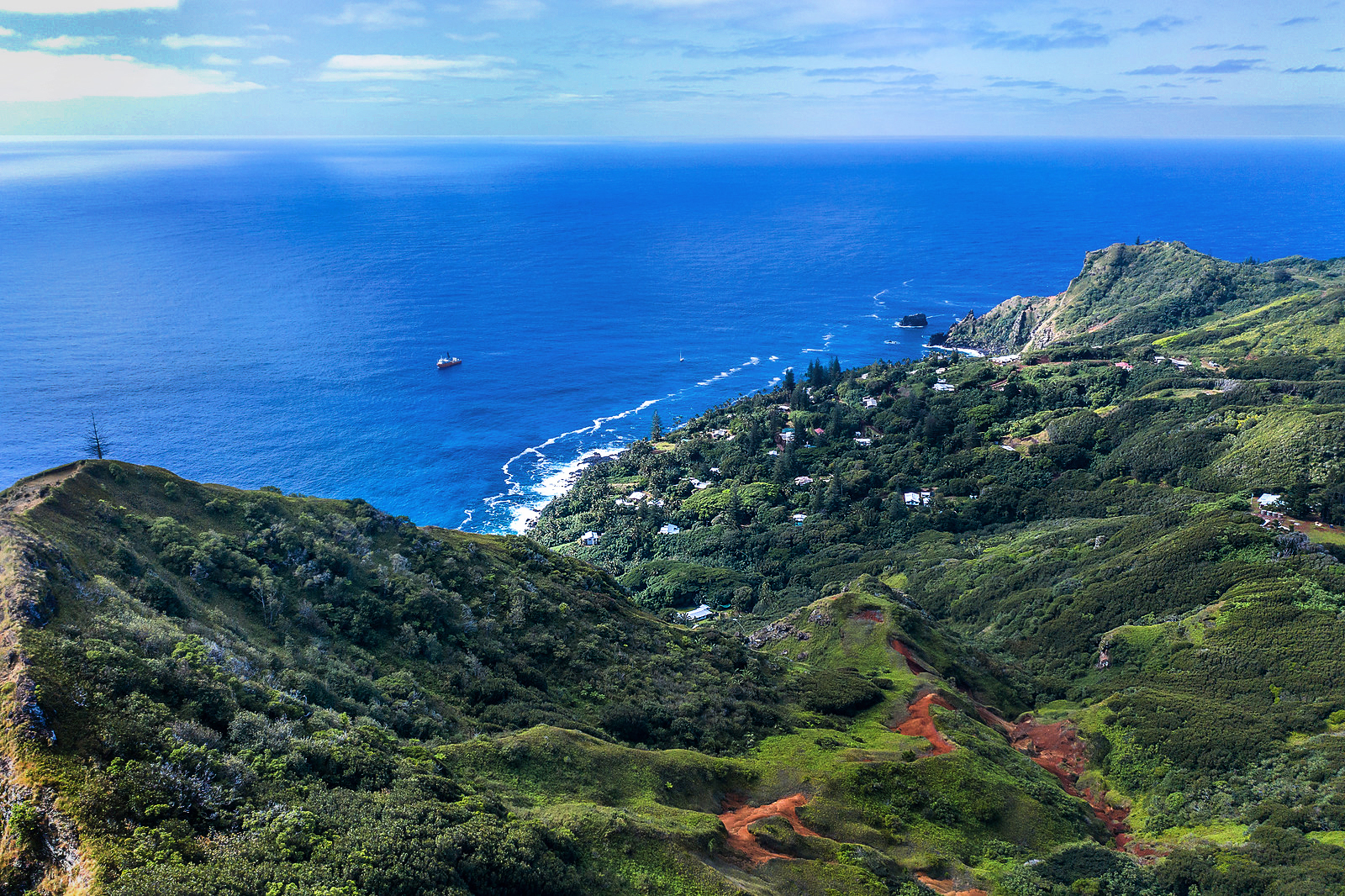
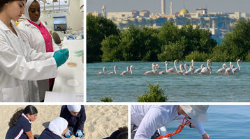
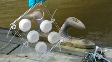
The findings are based on underwater surveys carried out across the outer islands of Henderson, Oeno and Ducie by 12 volunteers of the resident Pitcairn community – one-quarter of the total population of 47.
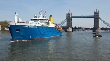
Ducie and Henderson were found to have some of the highest biodiversity in the subtropics, says the report prepared by Blue Abacus and supported by scientists from the Centre for the Environment, Fisheries and Aquaculture Science (Cefas).
As leaders come together to tackle the global biodiversity crisis at the UN Conference of Biological Diversity (CBD) CO15 in Montreal, the findings suggest protecting large parts of the ocean could help marine ecosystems and biodiversity to recover and thrive.
The abundance and diversity of species is also attributed to the Pitcairn Island’s healthy coral reefs, which have so far avoided some of the worst impacts of climate change. Further research looking specifically at these unique coral reef ecosystems found little evidence of bleaching from heat stress. Due to the clarity of the water, these reefs stretch down to deeper, cooler waters compared to most other tropical coral reefs, which offer some protection from rising sea temperatures caused by climate change.
However into the future, these coral reefs are still at risk from other effects of climate change including ocean acidification, cold-water intrusions from distant storms, and sea level rise. Their isolation from other reef systems could also make recovery difficult should climate impacts worsen.
The findings summarised in a recent report found that:
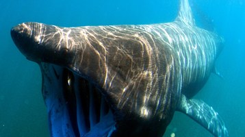
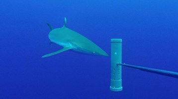
- Sharks were observed in over half (66%) of all the underwater surveys, with multiple species (such as Grey Reef shark, Galapagos shark and the Whitetip Reef Shark) observed in half (51%). It suggests that be ban on shark fishing has had an impact in supporting healthy shark populations, which are higher than the global average (it is estimated that sharks have disappeared from a quarter of the world’s reefs).
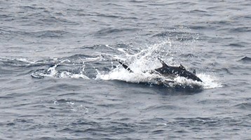
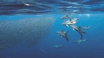
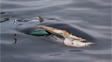
- Six individual Humpback whales were seen in the seabed footage with many more recorded from surface observations, including mothers and their calves. The age of the calves indicates that the whales are using the Pitcairn MPA as a calving and nursery ground safe from human activities and threats.
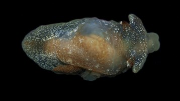
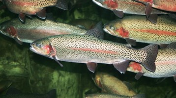
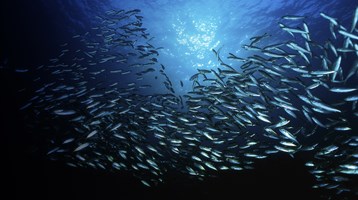
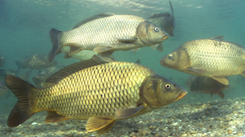
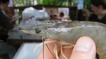
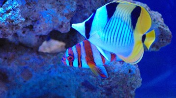
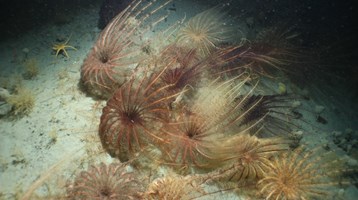
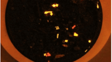
- A total of 7,319 individual fish were recorded from 203 different species, including endemic fish species, such as the many-spined butterflyfish (Hemitaurichthys multispinosus).
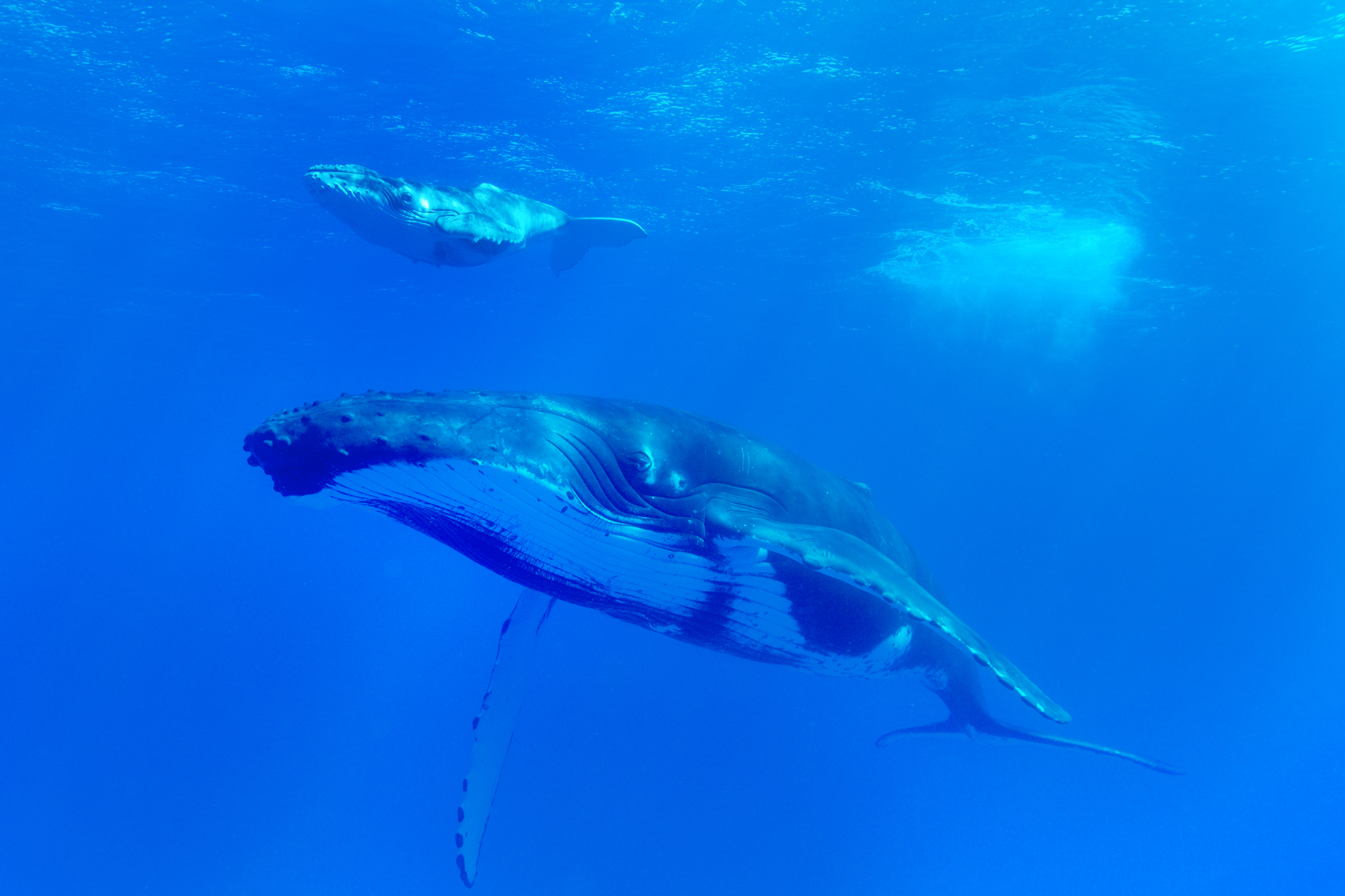
Humpback whale and Calf, Tom Jolly, Courtesy of the Marine Management Organisation
Lord Goldsmith, Minister for UK Overseas Territories and International Environment, said:
“The UK’s Overseas Territories are home to incredible biodiversity and these breathtaking survey results show what can be achieved when we empower local communities to act as guardians of their natural resources.
“Healthy oceans mean a healthy planet, which is why the UK’s Blue Belt Programme is leading the way in protecting millions of square kilometres for the benefit of all life on Earth.”
Alasdair Hamilton, Deputy Governor of the Pitcairn Islands, commented:
“This was an important expedition to capture essential data on marine life in one of the most remote places on earth. It has further opened our eyes to Pitcairn's unique and little-studied biodiversity.”
“Since designating the Pitcairn Islands a highly protected MPA in 2016, we have been working hard to build a better picture of its rich marine biodiversity and habitats in what is possibly the last remaining intact marine ecosystem left on the planet.”
“Through our protection efforts against illegal fishing and a ban on all commercial fishing, we are seeing evidence that Pitcairn’s MPA is a marine ecosystem in balance and in harmony and an example of why we need more highly protected MPAs globally to protect the health of the oceans – which in turn are critical to the health of our planet.
“This was a great team effort by Pitcairn Islanders and the UK Administrator, who trained themselves how to undertake scientific research and use cutting-edge technology. Their work to capture this information will help to not only protect Pitcairn’s MPA, but support global efforts to protect our oceans.”
Simeon Archer Rand, Senior Marine Advisor at the Centre for Environment, Fisheries and Aquaculture Science (Cefas) commented:
“The results of this landmark survey are a significant success for the Pitcairn Islands. This community in the Pacific Ocean are guardians of one of the world’s largest no-take Marine Protected Areas, providing a sanctuary for marine life in the vast Pacific Ocean. The island has strong cultural links to the ocean and their passion to protect it is clearly shown in their actions.
“Since 2016 we in the Blue Belt Programme have assisted the island community to further their ability to monitor their marine environment, as well as strengthen the governance of the invaluable MPA.
“The survey data collected will help Pitcairn to effectively manage the MPA, ensuring these key habitats are protected into the future.”
“But there is still a lot to learn. We are just beginning our journey in terms of understanding this globally important region”, he said.
Background
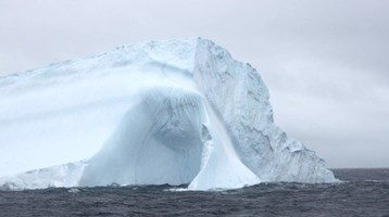
- The Pitcairn Islands in the South Pacific Ocean have one of the largest MPAs in the world. Made up of four islands, the no-take MPA established in 2016 covers 842,000km2 and is home to a huge range of marine species and exceptionally preserved coral reefs.
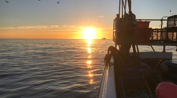
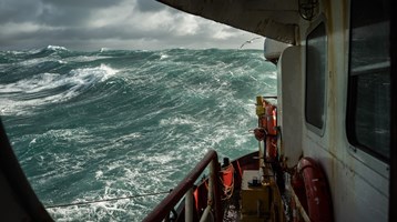
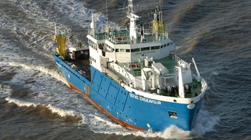
- MV Silver Supporter, a UK Government contracted vessel which usually acts as Pitcairn’s supply vessel, departed on 5 September 2021 and voyaged for around three weeks around the Pitcairn Islands. The survey was concluded on 19 September 2021.
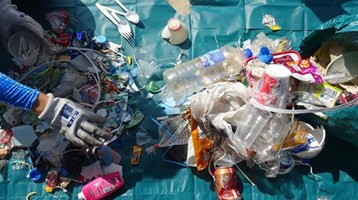
- The survey builds on a 2019 expedition where underwater camera and state of the art acoustic echo sounding technology to map the seabed. A survey on the impact of marine plastics was also carried out.
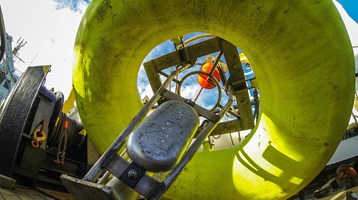
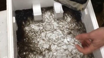
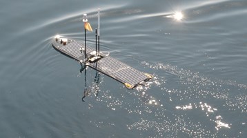
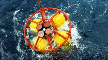
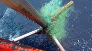
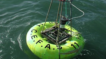
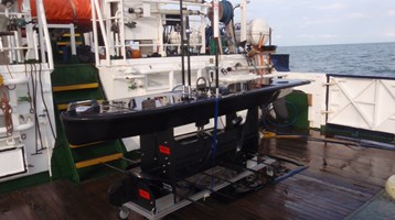
- The BRUVS deployed during the survey are those provided by the Blue Belt Programme’s Global Ocean Wildlife Analysis Network. Data collected by these BRUVS was sent to partner organisation Blue Abacus for processing.
- The Blue Belt Programme is a UK Government initiative to enhance marine protection across over 4.3 million square kilometres of marine environment in the UK Overseas Territories.
- The UK Overseas Territories are some of the most biologically interesting, and remote, places on Earth. From the vast penguin colonies of South Georgia & the South Sandwich Islands to the marine turtles of Ascension Island, the UK Overseas Territories are home to globally significant biodiversity.
- This flagship programme has been central to the UK Government’s ambition of leading action to tackle the serious global problems of illegal fishing, species extinction and climate change. The programme has underpinned the UK’s 25 Year Environment Plan and supported the achievement of UN Sustainable Development Goals. More recently, it has supported the UK’s commitment to ensure 30% of the world’s oceans are protected by 2030.
- The aims and objectives of the expedition were designed to support the fulfilment of objectives set out in the Pitcairn Islands Marine Management Plan (due for publication Autumn 2021).
- The Management Plan guided the types of activity and data collection that took place on the voyage. This included:
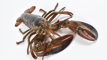
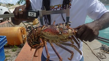
- Collecting data on lobster and shark populations.
- Recording marine mammal sightings.
- Habitat mapping to investigate potentially vulnerable areas.
- Monitoring for illegal, unregulated and unreported fishing within Pitcairn’s MPA and trailing the effectiveness of satellite data.
- The finding come as the RRS Discovery 159 returns from a 6-week voyage to the remote British Overseas Territories of Ascension Island and St Helena. Using underwater cameras, scientists on board carried out several surveys to study the region’s incredible biodiversity and seabed habitats four kilometres beneath the surface. The RRS Discovery operated by the Natural Environment Research Council, departed on October 27th 2022 and will return to the UK later this month where work will begin on analysing the specimens and data collected. A report is expected in 2023.
For further information, interviews or multimedia requests, please contact communications@cefas.gov.uk or catriona.moss@cefas.gov.uk.
Related to this article
Topic

Case studies


People


News


Further Reading