WaveNet data shows impact of May land heatwave on UK sea temperatures
16 June 2026

Sea surface water temperature readings from Cefas monitoring buoys around England and Wales show how the late-May land heatwave affected UK seas, consistent with reports from Mercator Ocean/Copernicus that UK waters have been unusually warm for this time of year.
Data taken at several monitoring sites on 25 and 26 May, during the hottest May days on record, show sea surface temperatures significantly above seasonal averages, with differences ranging from 2.6°C to 4.4°C higher than normal for this point in the year.
The largest difference was recorded at Hastings, where the sea reached 16.6°C on 26 May — nearly 4.5 degrees warmer than the site's usual May average. Similar spikes were seen at Liverpool Bay and Poole Bay, where temperatures reached close to 17°C.
Even in cooler northern waters, sites in the northeast, such as Dowsing (off the Lincolnshire coast) and Tynes and Tees, both recorded temperatures around 14°C — more than three degrees above their usual levels.
The late-May spike follows unusually high sea temperatures throughout April, consistent with data from Mercator Ocean/Copernicus of a prolonged marine heatwave in UK waters during spring 2026. In some locations, such as Hastings, sea temperatures have been unusually elevated since February. Since the peaks, temperatures have dropped back close to normal averages for June.
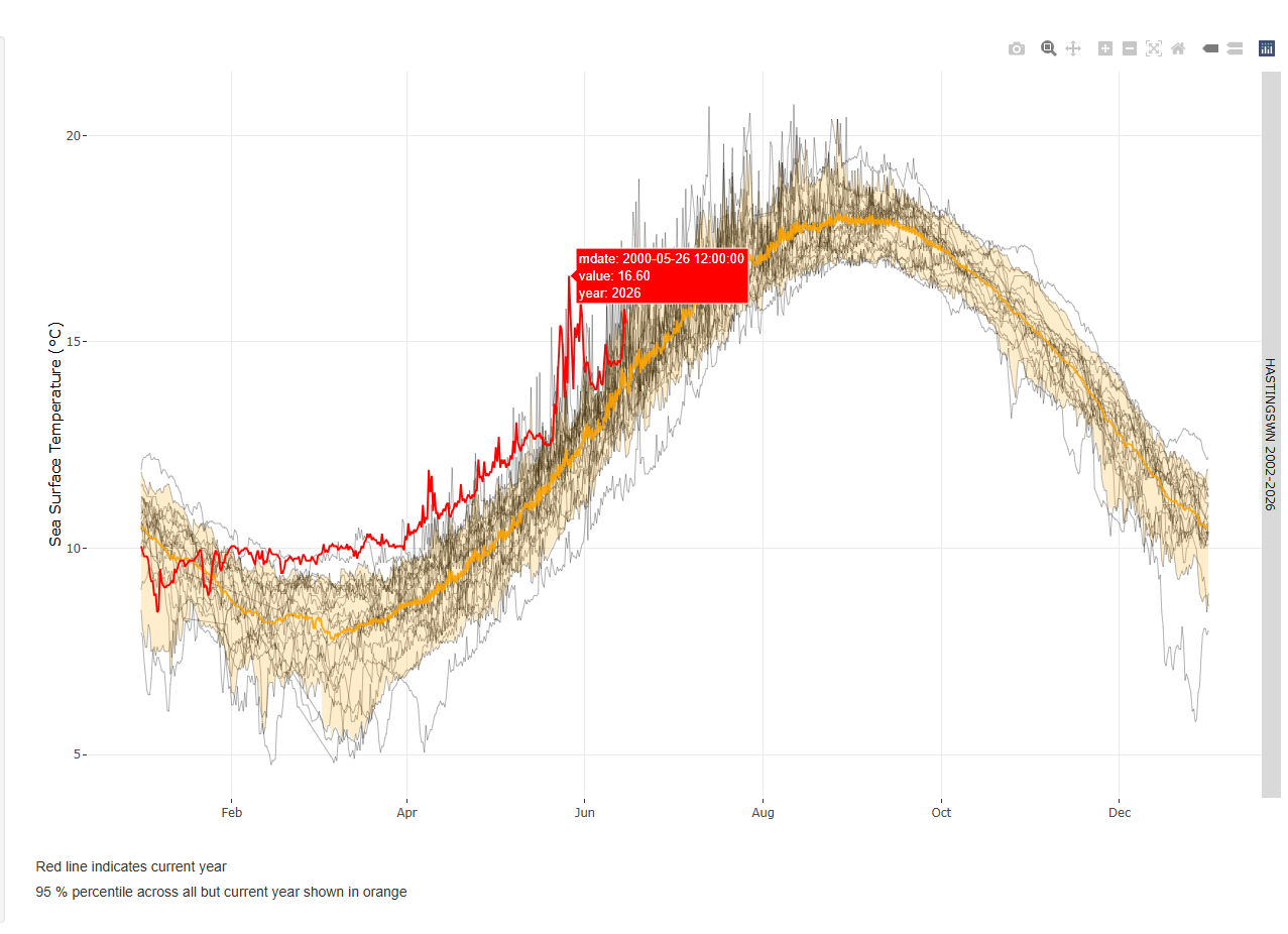
Figure 1: Sea surface temperatures for Hastings show a prolonged period of unusually high sea temperatures for April followed by a spike during one of the hottest May days on record. Monthly average based on data collected since 2002.
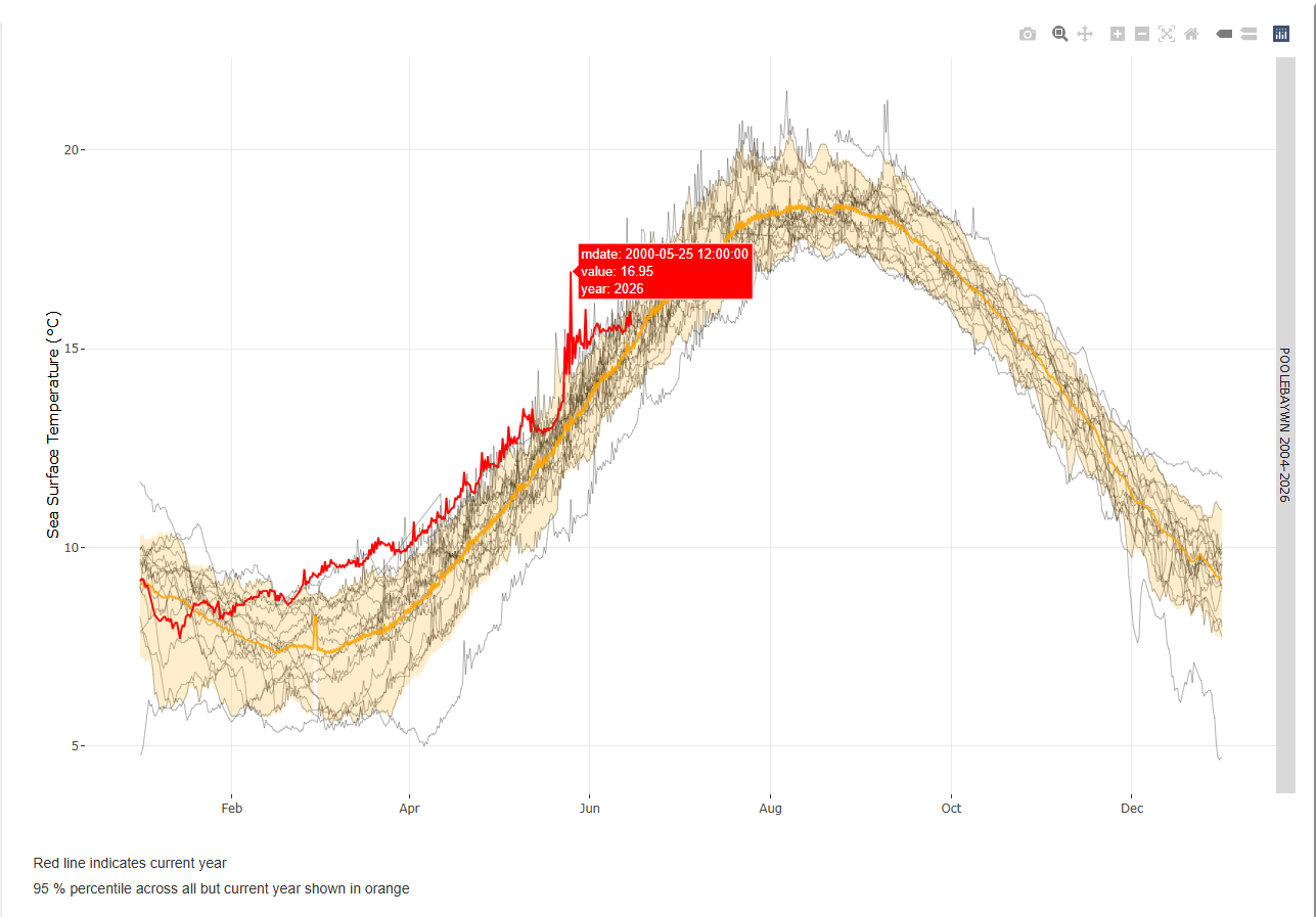
Figure 2: Sea surface temperatures for Poole Bay. Monthly average based on data collected since 2004.
Marine heatwaves – prolonged periods of abnormally high sea temperatures – can significantly affect the health of marine wildlife, disrupt ecosystems, and cause economic impacts to industries such as fisheries and tourism. According to a Marine Climate Change Impacts Partnership evidence brief published last year, sea surface temperature around the UK have warmed by 0.3°C per decade over the last 40 years, with marine heatwave events increasing by around 4 events per year.
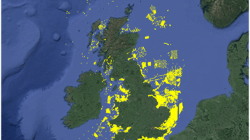
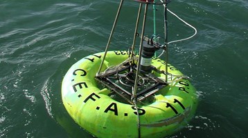
Established in 2002, WaveNet, provides real-time information on wave heights and temperatures from a network of wave buoys located around the UK coastline. The data, collected from a variety of third-party platforms and programmes (industry and public sector-funded), give an unprecedented insight into the changing conditions at sea around the UK.
In this blog, Cefas and the Met Office highlight how WaveNet data is helping forecasters, local authorities, and scientists to better understand the risks and impacts of climate change on the marine environment and coastal communities.
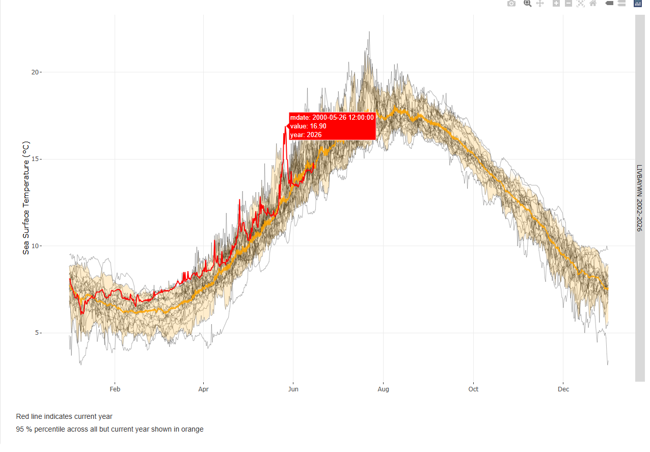
Figure 3: Sea surface temperatures for Liverpool Bay. Monthly average based on data collected since 2002.
Photo by Boris Misevic/Unsplash
Related to this article
Topic


Case studies


People


News


Further Reading